


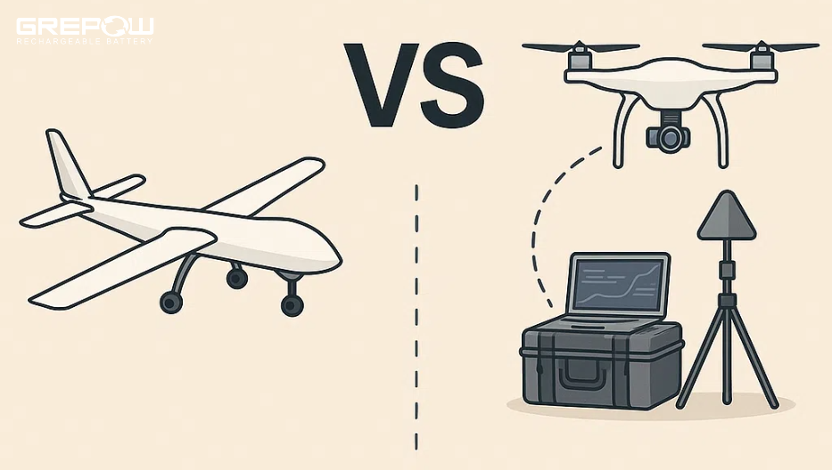
Photogrammetry vs. LiDAR 3D Drone Mapping: What’s the Difference?
When it comes to 3D drone mapping, both photogrammetry and LiDAR stand out as two of the most advanced techniques available today. Each method offers distinct advantages depending on the application, making it essential to understand the key differences. Photogrammetry relies on capturing overlapping images and stitching them together to create visually rich 3D models, while LiDAR uses laser pulses to generate highly accurate 3D point clouds, even in challenging environments. In industries ranging from construction to forestry, choosing between these technologies depends on factors like cost, precision, and the type of data needed.
What is Drone Mapping and 3D Drone Mapping?
Drone mapping, also known as aerial mapping or UAV mapping, is the process of capturing and analyzing aerial data using drones. The data gathered by drones is processed using specialized software to create various types of maps and models. These outputs are highly accurate and offer detailed insights into the surveyed area, making drone mapping a vital tool in industries like agriculture, construction, real estate, mining, environmental monitoring, and disaster management.

3D drone mapping is the process of using drones equipped with cameras and sensors to create accurate 3D models of landscapes, structures, and environments. Key techniques include photogrammetry, which uses overlapping images to generate models, and LiDAR, which uses laser pulses to create highly accurate 3D point clouds, even through vegetation. Other methods, like thermal mapping and multispectral imaging, capture heat or light data for applications in agriculture, energy audits, and environmental monitoring. These technologies are used in construction, mining, agriculture, and infrastructure inspections, providing fast, cost-effective, and detailed data for analysis.
What is Photogrammetry 3D Drone Mapping?
Photogrammetry is the most common technique in 3D drone mapping. It uses overlapping images taken from different angles to generate 3D models. By analyzing the displacement of pixels between these images, photogrammetry software reconstructs the geometry of the object or terrain in three dimensions.
How it works
The drone flies in a grid pattern, capturing multiple images that overlap (usually by about 60-80%). Photogrammetric software then stitches these images together to create a 3D model.
Pros
●Cost-Effective: Photo sensors are generally more affordable than LiDAR, making it accessible for various applications.
●Rich Visual Data: Captures color information (RGB data) that aids in visualization and rendering 3D models for digital twins using photogrammetry software.
●Detailed 3D Models: Suitable for creating intricate 3D models or high-resolution 2D maps.
Cons
●Accuracy Limitations: Overall accuracy relies heavily on the quality of photos which can be difficult to capture in complex terrains like caves.
●Lighting Dependency: Quality depends on lighting conditions, making it less suitable for dark environments such as underground spaces.
What is LiDAR 3D Drone Mapping?
LiDAR is a remote sensing method that uses pulsed laser light to measure distances between the drone and objects on the ground. It generates accurate 3D point clouds of the terrain or structures below, capturing even minute details.
How it works
LiDAR sensors mounted on the drone emit laser pulses that bounce off surfaces and return to the sensor. By calculating the time it takes for the pulses to return, the system generates a point cloud representing the terrain or object.
Pros
●GPS-Independent: Functions in enclosed spaces without reliable GPS, like underground mines.
●Works in Low Light: Can operate with little to no light, making it perfect for search and rescue, cave exploration, and mining operations.
●Real-Time Mapping: Creates maps on the go, with the ability to be quickly post-processed on-site.
●Delivers survey-grade accuracy.
Cons
●High Cost of Sensors: LiDAR sensors that power autonomous robots can be quite expensive which drives up overall platform costs.
●Advanced Requirements: Requires sophisticated hardware and software, explaining why clients choose Exyn for the most robust platforms and software.
Photogrammetry vs. LiDAR 3D Drone Mapping: What's the Difference?
LIDAR is an active remote sensing method based on laser technology and the measurement of rebounding light points. Photogrammetry is a passive remote sensing method that involves capturing and aligning a series of digital images that overlap, as well as location data associated with pixels. While both of these methods capture mapping information, the way to process that information and the analytics they avail differ.
Data collection
one key difference between LiDAR and photogrammetry is how data is collected. LiDAR uses laser pulses to measure distances and is an active remote sensing system. This means that the system itself generates energy (light). Photogrammetry uses passive sensing with photographic images. Passive sensors detect energy remitted or reflected from an object. While LiDAR can operate in the dark, photogrammetry relies on external ambient light and requires good lighting conditions. Photogrammetry generally cannot penetrate through dense vegetation, while LiDAR pulses can pass through gaps in the foliage and reach the ground like sunlight.
Data attributes
LiDAR collects different information than photogrammetry. LiDAR typically captures x, y, and z coordinates, as well as intensity values. These are integer values that vary with the composition of the surface object reflecting the laser beam. Laser scanners produce 3D point clouds that contain all 3D point measurements. Photogrammetry captures 2D imagery, after which photogrammetry software uses a method called triangulation to produce 3D point measurements so that x, y, and z coordinates are known for each point. Photogrammetric imagery also contains color information in the form of RGB values (red, green, blue) to produce visually rich 3D models. LiDAR can integrate an RGB camera to also capture color information along with the 3D points, but this is not the default option.
Cost
Photogrammetry is more affordable and accessible, requiring only a standard RGB camera and widely available drones like DJI Phantom or Mavic series. The software, such as Pix4D or DroneDeploy, is user-friendly with cloud-based options, though processing can be time-intensive depending on image volume and resolution. LiDAR, in contrast, is more expensive due to specialized sensors and the need for robust drones like the DJI Matrice series to handle the equipment. While LiDAR data processes faster since it doesn't require stitching images, it demands more expertise to interpret, making it more suited for professional and industrial use.
Use cases
Photogrammetry is ideal for applications requiring detailed visual information, such as in architecture, construction site monitoring, real estate, and historical preservation. It is commonly used for 3D modeling, large-scale 2D mapping, visual inspections, and progress tracking in construction, though its accuracy may be limited by poor visibility, vegetation, and lack of ground control points (GCPs). LiDAR, on the other hand, excels in providing high-accuracy elevation data in complex environments like dense forests or rugged terrain. It is widely used for forestry analysis, flood risk modeling, topographical mapping, and archaeological studies, but is more expensive and lacks the visual detail offered by photogrammetry, making it less suitable for aesthetic 3D modeling.
Conclusion
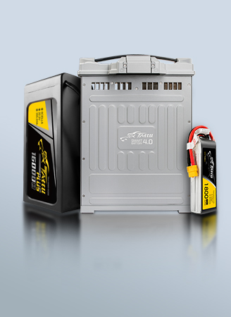
Ultimately, whether photogrammetry or LiDAR is the better choice comes down to the specific requirements of a project. Photogrammetry’s affordability and detailed visual models make it ideal for projects that prioritize aesthetics and large-scale mapping, while LiDAR’s precision and ability to function in low-light or dense environments make it the go-to for technical applications like topographical mapping and forestry. As a global leading lipo battery manufacturer, Grepow can provide high energy density and long lasting uav battery to meet the design requirements of various 3D mapping drones. If you have any questions or needs, please feel free to contact us at info@grepow.com.


Related Articles
-
Drone Batteries: A Comprehensive Guide
2025-06-23 -
What is an 8S LiPo Battery?
2025-06-20 -
UAV vs UAS: What’s the Difference?
2025-06-12
Related products
-
Tattu Plus 6S 22000mAh 22.2V 25C Lipo Smart Drone Battery
-
Tattu Plus 6S 16000mAh 22.2V 15C Lipo Smart Drone Battery
-
Tattu Plus 6S 12000mAh 22.2V 15C Lipo Smart Drone Battery
Comment(0)
Comment( Your email address will not be disclosed. Required fields are marked as * )